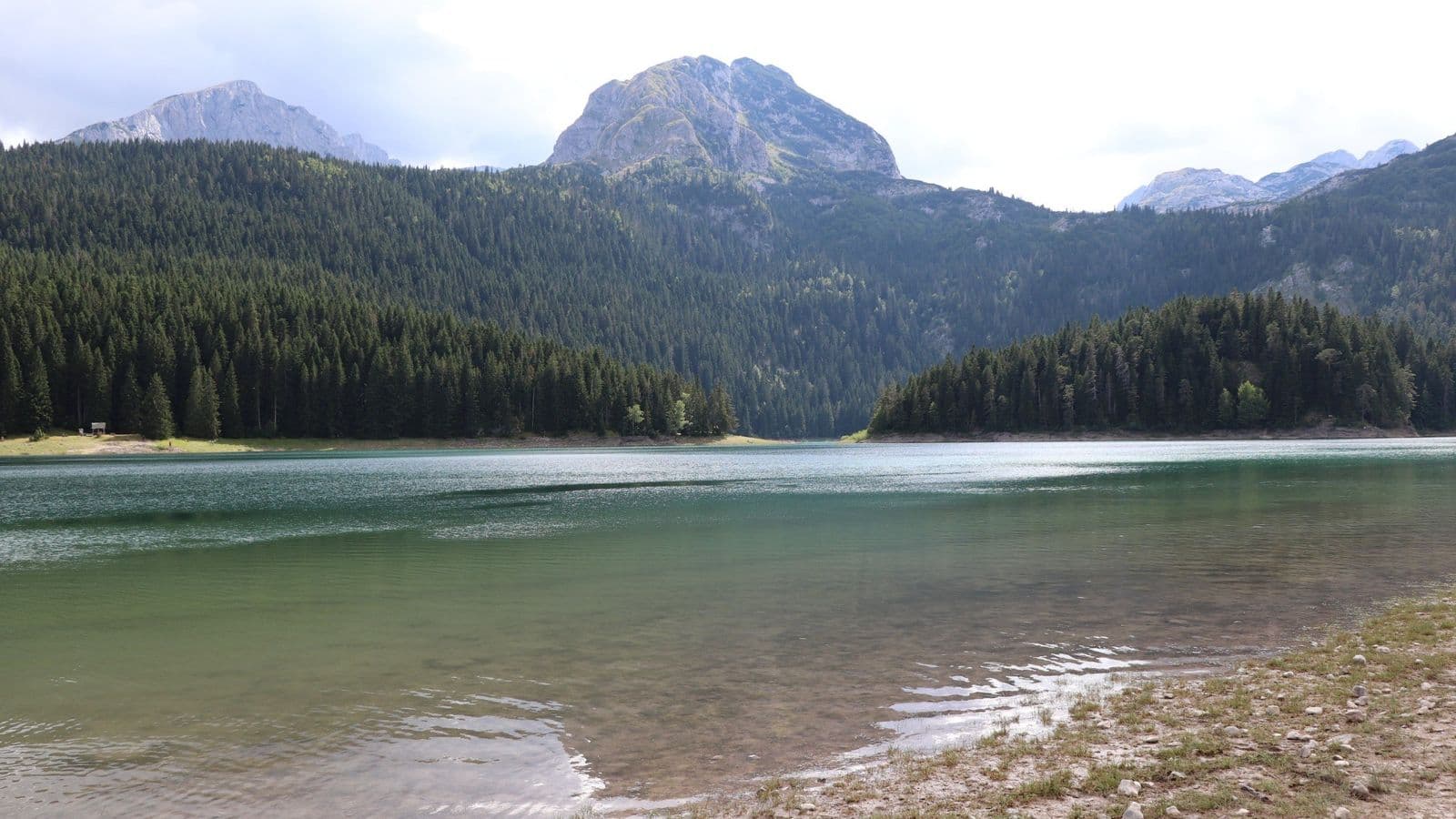
On 4 August 2019, I found myself in Durmitor National Park in northern Montenegro. I came home with plenty of photographs, yet memory is selective: what I remember most clearly is Crno Jezero and the striking quality of the air. It took several years before I returned to those images not only as a traveller, but also as a geographer, trying to understand why this relatively compact corner of the Balkans leaves such a strong impression.
A geography degree has a curious side effect: a beautiful landscape rarely remains merely beautiful for long. Behind the outline of a mountain you begin to look for the origin of its rocks; in the shape of a valley, for the work of an ancient glacier; beside a lake, for its catchment and underground drainage. Durmitor is almost ideal for this kind of looking. Within a small area, the tectonic history of the Dinarides meets Mesozoic marine sediments, karst, Pleistocene glaciation, mountain forests and a human landscape that has occupied this setting for only a very short time.
Žabljak: a resort on the high plateaus
For most visitors, Durmitor begins with Žabljak. The small town lies at roughly 1,450 metres above sea level and is now the main tourism centre of this part of Montenegro. Its resort history, however, predates modern mountain hotels. Travellers were already coming here from the Kingdom of Yugoslavia and other European countries before the Second World War; after the war, Žabljak was rebuilt and gradually developed as a centre for mountain and winter tourism [1].
Skiing on Durmitor also has a much longer history than today's infrastructure might suggest. Organised skiing groups appeared in Žabljak in the 1920s, and by the second half of the twentieth century the area was hosting competitions at the Yugoslav level and developing permanent sports facilities [2]. The tradition continues today: the slopes of Savin Kuk contain a ski centre with runs of varying difficulty [3]. The same terrain that appears in summer as green upland meadows, conifer forests and exposed limestone becomes a winter skiing landscape.
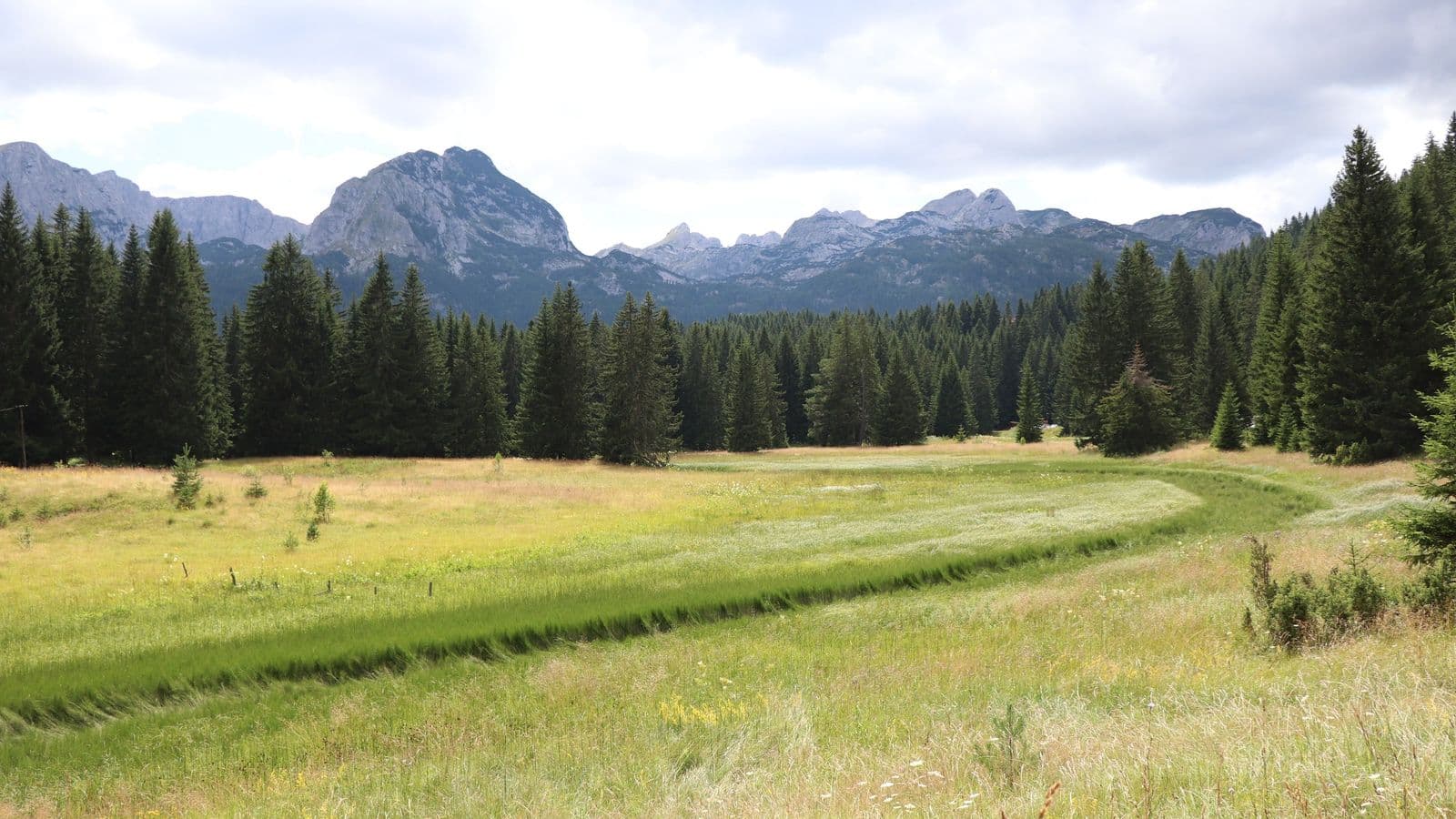
The resort history was not the only thing that caught my attention. At university, palaeogeography was taught to us by Nikolai Grigoryevich Tsiberkin, associate professor at the Department of Physical Geography and Landscape Ecology at Perm State University [4]. His lectures return here from a different angle: not as a set of maps and reconstructions of the past, but as a way of reading a present-day landscape through the sequence of processes that produced it.
Palaeogeography trains you not to treat the Earth's surface as static scenery. Modern land may once have been seabed; a valley may have changed both its origin and function several times; vegetation may occupy a relief whose history began long before the current ecosystem existed. Russian and Soviet geography developed a substantial palaeogeographic tradition, and one of its classic university texts was Konstantin Markov's 1951 Palaeogeography (Historical Physical Geography) [5]. Years after university, Durmitor unexpectedly felt like a field illustration of that discipline.
Mountains that began in the sea
Durmitor belongs to the Dinarides, or Dinaric Alps, which extend along the western Balkans. The regional geology is complex, but the massif contains thick successions of Mesozoic carbonate rocks. UNESCO specifically notes limestones of Middle and Upper Triassic, Upper Jurassic and Upper Cretaceous age and treats the area's geological and geomorphological features as part of the park's outstanding value [6].
Translated from geological terminology into landscape, the story is striking. Much of the material that now forms these mountains accumulated in ancient marine basins. Modern research links the evolution of the Dinarides to the eastern margin of the Adriatic microplate and to the long history of the Neotethys oceanic realm. At different stages, the region experienced rifting and basin opening, subduction, the formation of ophiolitic complexes, the accumulation of deep-water sediments and, eventually, continental collision [7].
The grey limestone walls rising above the conifer forest are therefore not simply a mountain mass. They are the result of several fundamentally different geological environments. Marine sediments became rock; those rock successions were later folded, displaced along thrusts and uplifted; erosion then exposed them again at the surface.
UNESCO also draws attention to strongly deformed units on Durmitor, including the so-called Durmitor Flysch, where beds may stand at extremely steep, almost vertical angles [6]. Flysch itself is a thick succession of marine sedimentary rocks; the present attitude of those beds records a later tectonic history. In that sense, the landscape of Durmitor can be read almost like a geological section, except that instead of a few metres of outcrop, an entire mountain massif fills the view.
When karst met a glacier
Once the mountains had formed, water continued to reshape them. Carbonate rocks are particularly susceptible to karst processes: water enters fractures, gradually dissolves limestone, enlarges cavities and creates sinkholes, dolines and underground conduits. By the time major Pleistocene glaciations reached Durmitor, the surface was already a complicated landscape produced by tectonics, fluvial erosion and karst.
Then the ice arrived. Predrag Djurović's reconstruction of Pleistocene glaciation on Durmitor shows the scale of that transformation. During the most extensive identified glacial phase, glacial landforms occupied more than 54% of the massif; during the next major phase, about 36% [8]. The movement of ice and the positions of glacier tongues were themselves strongly influenced by geological structure and by pre-existing karst and fluvial forms.
That is one of Durmitor's defining features. The glaciers did not begin with a blank surface; they reworked a landscape that already had a long history. Ice occupied depressions, widened and deepened valleys and cirques, modified slopes and, after retreating, left a set of forms that continued to be altered by water, frost weathering and karst processes. The national park's own management materials specifically note the combination of well-preserved glacial landforms with a strongly developed pre-glacial karst relief [9].
The result is neither simply a "glacial landscape" nor simply a "karst landscape", but a polygenetic one in which many forms reflect a sequence or combination of processes. Textbooks can separate them neatly. Real mountains, as usual, show little interest in keeping the categories tidy.
Crno Jezero: two basins, one history
Crno Jezero, or Black Lake, lies at the foot of the Međed massif and is the largest and best-known of Durmitor's glacial lakes. Eighteen such lakes occur across the massif, poetically known in Montenegro as gorske oči, the "mountain eyes" [10].
Even Crno Jezero itself is more complicated than it first appears. It consists of two basins, Veliko jezero and Malo jezero, joined by a narrow water passage. Official Montenegrin data give the larger basin an area of about 0.338 km² and the smaller one about 0.178 km². Yet the maximum depth of Veliko jezero is 24.5 metres, while Malo jezero reaches 49.1 metres [11].
That produces a neat morphometric paradox: Malo Jezero is almost half the surface area, but roughly twice as deep. Its total water volume is even slightly larger, about 4.55 million m³ compared with roughly 4.15 million m³ in Veliko Jezero [11]. The names describe the surface area quite well, but say almost nothing about the three-dimensional geometry below the waterline.
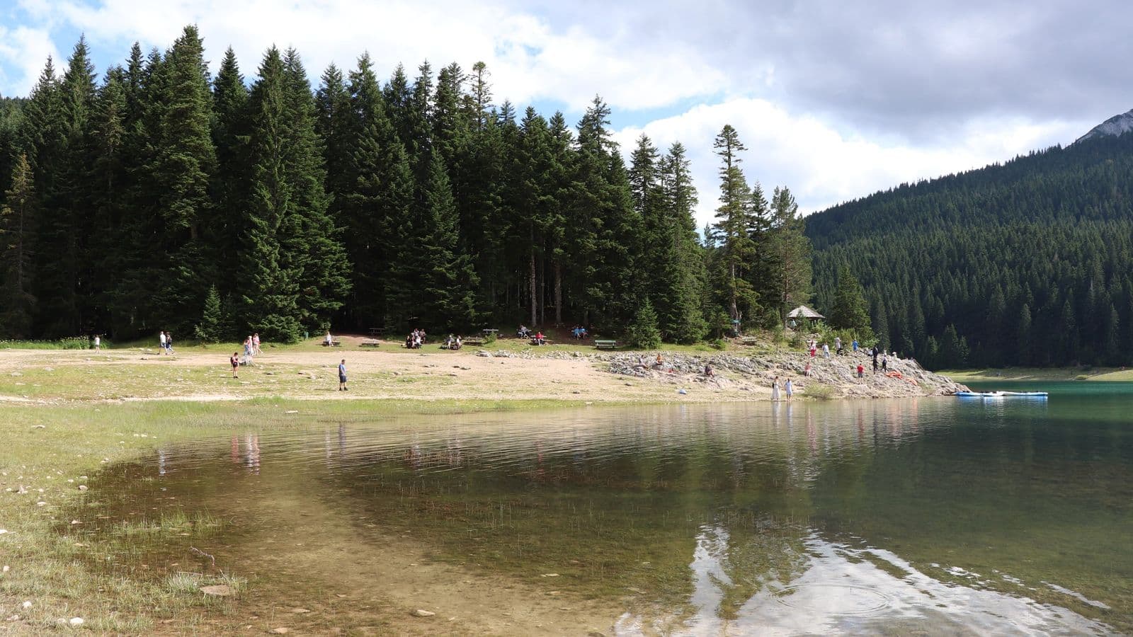
Water levels vary considerably through the year. Snowmelt and temporary streams add to the lake's supply in spring; in summer, levels fall, parts of the shore emerge, and the connection between the two basins narrows and can be interrupted during some periods [11]. My photographs from early August show a broad exposed shoreline. It would be too confident to reconstruct the precise hydrological state of the lake from a single photograph, but its seasonal change is visible even without instruments.
The lake's glacial origin explains only part of its form. Modern Crno Jezero exists within a karst massif, so its water balance depends not only on precipitation, surface runoff and evaporation, but also on a complicated system of underground drainage.
A drainage network that continues underground
On an ordinary topographic map, a river network is relatively easy to read. Water flows downslope, gathers in valleys, and higher ground forms divides between drainage basins. In karst terrain, that logic is incomplete. Surface and underground divides may not coincide; water can disappear into a sink, move through fractures and conduits, and reappear far from the point where it entered the rock.
This is why Crno Jezero is interesting not only as a glacial lake, but as part of a larger hydrogeological system. Montenegro's national parks describe its connection with runoff toward the two major river systems of the Tara and the Piva and refer to the phenomenon as bifurcation [10]. This is not a simple surface fork where one stream divides into two channels. It is a more complex combination of surface and subterranean drainage through a limestone massif.
In karst regions, that behaviour matters because topography alone does not fully determine the direction of water movement. Underground catchments can cross surface watershed lines, while recharge and discharge zones may be separated by considerable distances. UNESCO specifically notes caves, underground rivers and karst drainage affecting some of Durmitor's glacial lakes [6].
From the shore, Crno Jezero looks calm enough: water, forest and rock. Yet a significant part of its hydrology is hidden inside the mountain. That is one of the pleasures of karst geography: some of the most interesting parts of the landscape are precisely the parts you cannot see directly.
High Durmitor: where the rocky framework emerges
As you climb away from Žabljak and Crno Jezero, the landscape gradually changes. Conifer forests thin out and give way to subalpine and alpine meadows; higher still, the rocky framework of the massif becomes increasingly exposed. Here the steep limestone slopes, karst dissection and forms associated with ancient glaciation become easier to read.
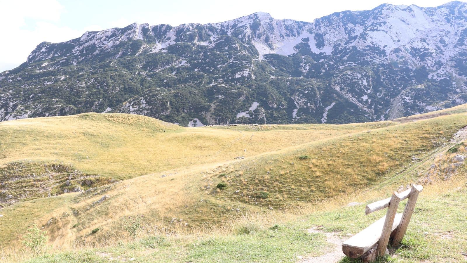
This is where it becomes especially clear why Durmitor entered the UNESCO World Heritage List not only for its exceptional scenery, but also for its geological and geomorphological value. Glacial and karst landforms occur side by side across a relatively small area; deep river canyons expose the structure of the massif, while the overall pattern of the relief reflects the complicated tectonic history of the Dinarides [6].
The high country also illustrates something else familiar to geographers: every modern landscape is both natural and cultural. Roads and walking routes cross forms created over tens of millions of years; ski pistes operate on the slopes in winter; mountain pastures are used in summer.
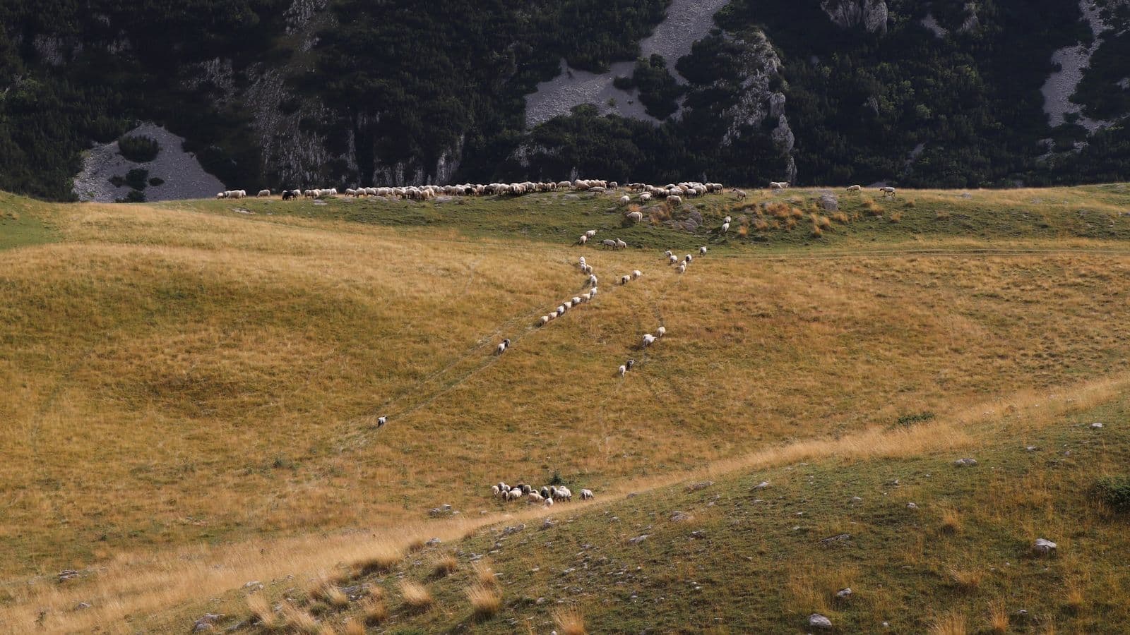
That contrast stands out in old photographs. The rock mass and glacial landforms establish an enormous timescale, while ordinary contemporary life unfolds immediately in front of them. It recalls one of the basic ideas of palaeogeographic thinking: the present landscape is not an endpoint. It is one temporal slice in the continuing development of the geographical environment.
The forest around Black Lake
At Crno Jezero, the geological landscape meets the forest almost at the water's edge. Dark conifers form a dense frame around the lake and are sometimes reflected so strongly that the name Black Lake begins to make intuitive sense. Depending on the light, the surface can appear blue, green or nearly black, even though the water itself remains relatively clear.
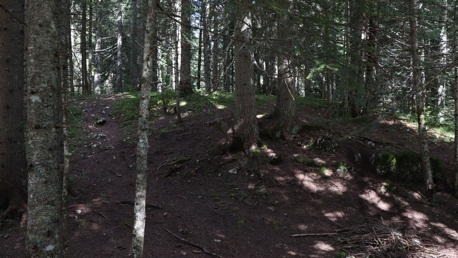
The forest influences more than the view. Conifers release biogenic volatile organic compounds into the atmosphere. Such forests contain a range of monoterpenes, including α-pinene, β-pinene and limonene, whose concentrations vary with plant species, temperature, light, season and time of day [12]. These compounds contribute to the characteristic scent of needles, resin and sun-warmed forest.
Elevation adds another layer. Žabljak stands at roughly 1,450 metres above sea level, Crno Jezero only slightly lower, and the climate of high Durmitor is distinctly cooler than the Montenegrin coast [1][10]. Even in August, temperature and humidity feel very different from the Adriatic. Forest, open water, mountain relief and a far lower level of human disturbance combine into an environment that no photograph can quite reproduce.
Perhaps that is why I keep returning to this journey years later. The old photographs now invite questions about Mesozoic basins, the tectonics of the Dinarides, karst, Pleistocene glaciers, the origin of the lake basin and subterranean drainage. Somewhere in those reflections, I also remember Nikolai Grigoryevich Tsiberkin's university lectures and the palaeogeographic reconstructions that once existed for us mainly on maps and in textbooks.
Here, all of it was gathered into one real landscape. For me to stand on the shore of Crno Jezero on 4 August 2019, ancient seas first had to exist here. Their sediments became rock; tectonic processes uplifted and deformed those rocks; water began to carve a karst landscape; glaciers repeatedly occupied the mountain valleys and basins; and after the ice retreated, water once again became one of the main forces reshaping the surface.
It is a very long history, yet the memory that remains is remarkably simple.
Durmitor is a place where breathing feels easy.